
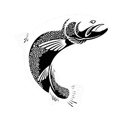
TAIMEN FISHING
The Taimen fish (Hucho taimen) inhabits the rivers and lakes of both the Arctic and Pacific Ocean basins. In the Arctic basin, it is found in the Selenge River and its tributaries, including the Ider, Chuluut, Delgermurun, Eg, Uur, Orkhon, and the upper reaches of the Tuul River, as well as the Yeruu, Shishkhid, Tengis, Khug, Dood Tsagaan Lake, Tamir, Suman, and Terkh Lake. In the Pacific basin, the species occurs in the Kherlen, Onon, Balj, Numrug, and Khalkh rivers, as well as Buir Lake.
KHERLEN RIVER
The Kherlen River originates in the Khentii Mountains and flows 1,382 km through the eastern part of Mongolia, flowing into Lake Hulun in China, and then becomes one of the sources of the Amur River, passing through Russia and China before flowing into the Pacific Ocean north of the Japanese islands through the Agnuur Sea. The Great Khentii Mountains branch is named "Kherlen River" after the confluence of the Kherei Tolgoi, the Bogd River, which originates from the Budan Tsagaan, and the Tsagaan River, which originates from the Kherei Tolgoi at the foot of the Khentii Khan Mountain. The main feeders of the Kherlen River are the Bogd River, Khoriud, Iluur, Khongon, Terelj, Tenun, Gurvan Saikhan, Zorgol, western and eastern Burkh, Bayangol, Gutai, western, eastern and middle Baidlag, and 37 large and small rivers flowing in the areas of Umnudelger sum of Khentii aimag and Mungunmort sum of Tuv aimag. Below Baganuur, 4 rivers flow into it: Galuut River, Tsenkher River, Avarga River, and Murun River. It flows from the forest-steppe zone of the Khentii Range to the dry steppe zone, and the river is 2020 meters above sea level at its source and 625 meters at its end. Water and meteorological watchmen have been stationed along the Kherlen River and have been conducting regular observations and measurements. Based on the data of the guards, the average flow over many years was determined to be the highest in the Baganuur district, 23.5 m3/second, in the Chinggis city area 21.4 m3/second, in the Choibalsan city area 19.4 m3/second, and in the Altan Emeel city area of China 14.2 m3/second. The water level of the river in the warm season decreases to an average of 200-220 cm in the upper reaches of the river, around Baganuur district, 150-170 in the middle reaches, and 130-160 cm in the lower reaches, around Choibalsan city.


ONON RIVER
The Onon River is the first major tributary of the Black River, originating in the Khentii Mountains of Mongolia. Its catchment area is 94,010 km². It flows northeastward for 298 km through Mongolia, crosses the border of the Russian Federation, and flows through the Inner Baikal region of Siberia. It flows for 445 km through Mongolia, and for a total of 818 km, it merges with the Ingoda River to form the Shilka River. The Onon River freezes from the end of October until it freezes in the second half of November, and is covered with ice for 150-170 days. The average thickness of the ice reaches 1.2-1.5 m. Since it is a fast-flowing mountain river, the autumn freeze lasts for relatively long days (14-25). As April warms up, the river ice thaws and the snow melts, causing spring floods, so the river is not so clear for long. The Onon-Shilka-Khar River is one of the top 10 longest rivers in the world (818 km + 560 km + 2874 km). The Onon River is a mountain river, so it has a high gradient and a fast flow. In some places, the flow speed reaches 1.5-2.0 m/s, but below the Balj confluence it decreases to about 1.0 m/s. The major tributaries of the Onon River, the Agats, Balj, Eg, Barkh, and Jargalant rivers, flow through mountainous terrain with steep slopes.
BALJ RIVER
The Balj River is the largest tributary of the Onon River. It originates from the Khumul Saridag Mountain, located between Burkhan Khaldun and Sokhond, a continuation of the Khentii Range in Russia, and flows for more than 40 km in Russia and about 180 km in Mongolia, before joining the Onon River at Ishin Mountain and Khadyn Uvur in Dadal Sum. The river valley widens towards the end, and its flow branches off into several dense islands. Major rivers such as Khyurkhan, Khumul, Amgalant, Galttai, and Tengeleg flow into the Balj River.


